A human navel is the trace of a life once connected to another life. For that reason many cultures attached the words “navel” and “center” to the rock, island, capital, or sanctuary that bound their world together. The same metaphor, however, does not guarantee the same meaning.
Uluru, Rapa Nui, Cusco, and Delphi did not become centers through natural scale alone. The law of caring for land, the ways ancestors are remembered, imperial roads and ceremonies, and pilgrimages to consult an oracle made these places central. This article reads the differences among the four centers while separating romantic nicknames from verifiable history.
1. Why a map cannot supply one uncontested “true center”
The Earth’s surface is nearly a sphere. So before calling any place the “middle of the world,” one must first decide on a criterion. Different methods produce different coordinates. These include a continent’s center of gravity, the point farthest from the coast, the midpoint of latitude and longitude, and the average point of inhabited land. Geoscience Australia makes the same point. It explains that Australia has no official center, and that each method of calculation yields a different possible center.
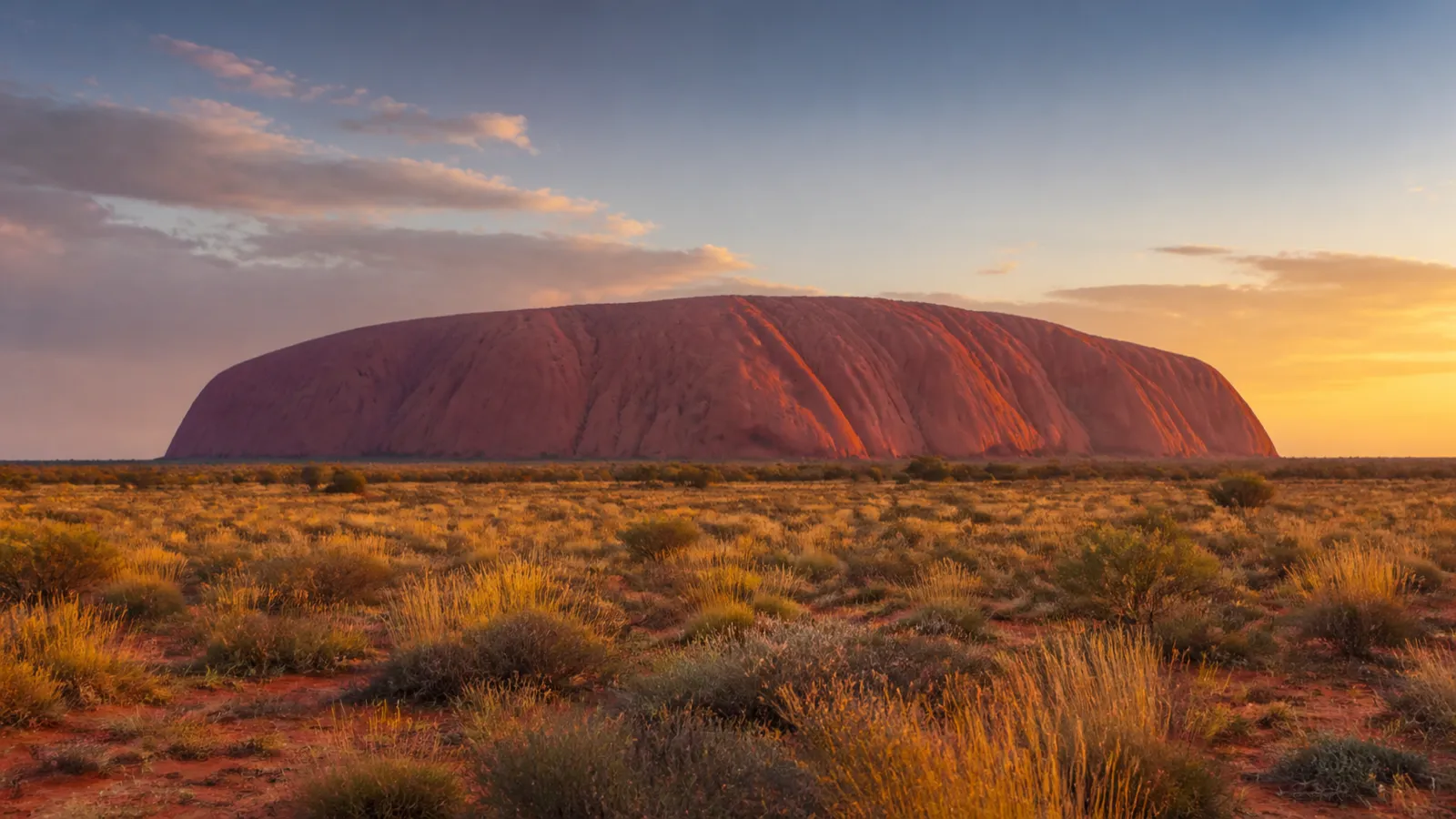
Uluru is an immense rock formation in Central Australia. Calling it the exact middle of the Australian continent is therefore not a geographical fact. The phrase combines two things: the impression created by its location in Central Australia, and a tourism narrative. This distinction does not lower the value of the place. Instead, it makes something clear. These four places matter not because of mathematical coordinates, but because of the ways people organized their worlds around them.
2. A “navel” speaks of relationship rather than coordinates
The navel metaphor usually carries three meanings: “the starting point of everything,” “the knot that joins the outside to the inside,” and “the place from which authority spreads.” What makes a place central can differ. For islanders, centrality may be created by the link between ancestors and land. For an empire, it may come from the node where roads and administration meet. For a sanctuary, it may come from communication between humans and gods.
We should not merge the four cases into a single universal myth. Instead, we should ask three questions. Who called a place central? When? And in which language?
Several kinds of sources need to be told apart: a nickname attached by modern tourism promotion, a colonial-era record, a community’s present self-description, and a myth in classical literature. Only by distinguishing them can we keep the word “mystery” from erasing actual history and actual people.
This framing keeps the four places from being ranked against one another. It shows that the real basis for comparing them is whose voice calls each one a center.
3. Uluru: an immense Central Australian formation, not a surveyed continental midpoint
Uluru is an arkose sandstone formation rising about 348 meters above the surrounding plain and measuring roughly 9.4 kilometers around. Iron-bearing minerals weather at the surface, while low-angle light intensifies reds, oranges, and purples at dawn and sunset. Claims that it is the world’s “largest monolith” depend on disputed geological categories and are less useful than these measured dimensions.
Uluru–Kata Tjuta National Park, the park that contains Uluru, entered the World Heritage List for its natural values in 1987. In 1994, the cultural values of the Aṉangu, the area’s Indigenous Traditional Owners, were added. This made it a mixed World Heritage property. That history, too, shows that nature and culture do not stand apart.
Official Aṉangu materials, however, do not present Uluru with a self-description meaning “navel of the Earth.” So that nickname should not be repeated as though it were an Indigenous belief of their own.
Read alongside the earlier point about calculation methods, “navel of the earth” turns out to be neither a survey result nor what the Aṉangu call the place. It reads more like a name from the tourism narrative.
4. Tjukurpa, the Aṉangu’s living law, and the 2019 climb closure
Tjukurpa, the Aṉangu’s living law, is not merely a collection of creation stories. It encompasses Aṉangu law, knowledge, moral and religious philosophy, kinship, and responsibilities for caring for Country. In 1985, title was handed back to the Traditional Owners. After that, Aṉangu and the Australian government established joint management. Today, Indigenous nominees hold a majority on the park’s board.
The Uluru climb was permanently closed on 26 October 2019 by decision of the board. This was not only a matter of preventing damage to nature; it was the result of Tjukurpa and Australian law working together. Visitors should keep to the designated paths, respect sensitive areas where photography is restricted, and read the cultural center’s explanations first. Uluru’s centrality appears in a relationship of land and responsibility, not in conquering a summit.
The climb closure shows that even visitor rules are set by a living community. The same principle can be seen in Ma’u Henua’s management of Rapa Nui.
5. Rapa Nui: does Te Pito o Te Henua mean “navel” or “land’s end”?
Rapa Nui lies about 3,700 kilometers west of South America and more than 1,900 kilometers from the nearest inhabited island. Its isolation helps explain the appeal of translating Te Pito o Te Henua as “the navel of the world.” UNESCO-linked scholarship, however, gives “the navel or end of the world.” Different segmentation and transmission histories support readings such as “navel of the land” and “land’s end,” while the name’s antiquity is also debated.
Some research likewise treats the name “Rapa Nui” itself as one that took hold in the nineteenth century. Consider a sentence such as “the islanders have called their island the navel of the world since time immemorial.” It flattens the historical layers into a single line.
A safer formulation states two things. Both senses, center and edge, have been handed down for this island. And their translation and dating are still under discussion.
That one name can carry both “center” and “end” shows that what counts as a center depends on where one stands.
6. Moai are not a riddle of the sea but the gaze of ancestors, land, and community
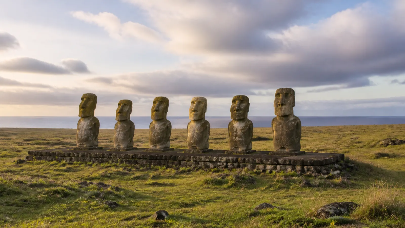
Many moai, the ancestral figures of Rapa Nui, were erected on coastal ahu. Most of these face not the sea but the community’s settlements and lands. They are interpreted as ancestors watching over descendants and territory. There are exceptions, though: some stand inland or face other directions.
So rather than saying “they all face the sea” or “they all turn their backs to the sea,” one should check the context of each site. Archaeological experiments and oral traditions about who moved the moai, and how, have also accumulated. There is no reason, then, to consume them merely as an unsolved mystery.
Deforestation occurred, but the popular “ecocide” script—a self-inflicted demographic collapse in the 1600s—has been challenged by archaeology and genetics. A 2024 ancient-genome study found no evidence of the severe pre-European population bottleneck proposed by that story and emphasized resilience. Later violence, introduced disease, and nineteenth-century slave raids must not be erased. Today the Indigenous community Ma’u Henua manages the national park and sets rules for access, conservation, and tourism.
Setting the popular “ecocide” story beside the 2024 study changes the picture of the island. Rapa Nui can be read not as an island that destroyed itself but as a community that endured and now manages its own heritage.
7. Cusco: the working center of Tawantinsuyu’s four regions and road system
At about 3,400 meters in the Andes, Cusco served as the political, religious, and administrative capital of Tawantinsuyu, the Inca state. Tawantinsuyu was conceived through four suyus—Chinchaysuyu, Antisuyu, Kuntisuyu, and Qollasuyu—and major routes extended from Cusco’s central space toward them. People, goods, labor obligations, armies, and ceremonies made centrality materially real.
The Qhapaq Ñan comprised more than 30,000 kilometers of roads across what are now six countries, joining mountains, deserts, and valleys. It gives substance to Cusco’s claim as an imperial center, but the network also enabled conquest and extraction. A “cosmic capital” should not be romanticized until the administrative power behind its roads is visible.
Unlike Uluru’s nickname, Cusco’s centrality rests on something concrete: roads and administration. That is why it holds regardless of the etymological debate in the next section.
8. “Cusco means navel” is a famous interpretation, not settled etymology
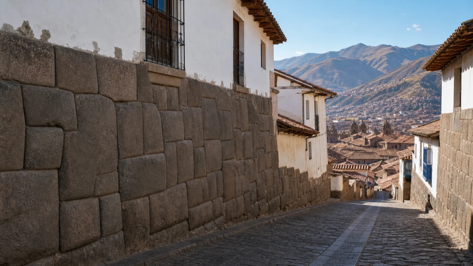
Cusco was the working center of Tawantinsuyu, the Inca realm of four regions. In a 1609 work, Garcilaso de la Vega, an author of Inca descent, explained Cusco as the Quechua word for “navel.” This explanation spread widely around the world.
Modern linguistics, however, does not regard it as a settled Quechua etymology. Rodolfo Cerrón-Palomino has drawn on evidence from the Puquina and Aymara languages. He has proposed that the name may be an older place-name referring to a bird of prey. “Navel” is an important historical interpretation, but it is not the only linguistic conclusion.
Cusco’s sacred landscape should not be reduced to modern claims about “energy lines.” Scholars count 41 or 42 ceques and 328 huacas radiating from Qorikancha; the count depends on the reconstruction. Together they connected temples, springs, rocks, hills, social groups, duties, and a ritual calendar.
Later, Spanish colonial structures rose over and beside Inca masonry. The city was inscribed as World Heritage in 1983. Today, it makes successive claims to centrality visible in stone.
Delphi’s omphalos literally means “navel.” Cusco’s “navel” differs in kind: it is an interpretation that spread from a 1609 gloss.
9. Delphi: the eagle myth, the Pythia’s oracle, and the precise meaning of the omphalos
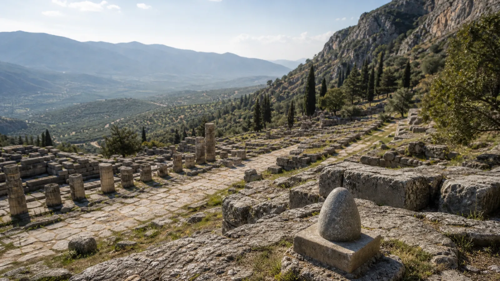
In Geography 9.3.6, Strabo records a tradition about Delphi. According to it, Zeus released two eagles, one from the east and one from the west, and they met at Delphi. The marker was an omphalos, which literally means “navel” in Greek.
This was not an ancient survey coordinate. It was a mythic account of Apollo’s sanctuary as the meeting place of the human world and divine counsel.
City-states and individuals came to Delphi to consult the oracle delivered by the Pythia. They asked about war, colonization, law, and religious matters. Delphi thus became a center where Panhellenic (all-Greek) memory and authority crossed. It was inscribed as a World Heritage property in 1987.
The famous omphalos in the museum today is not the mythical “original stone” itself. It is an omphalos representation that decorated the “Dancers of Delphi” column around 330–325 BCE. Likewise, the stone in this article’s AI image is a symbol used to explain the concept. It is not a replica of that artifact.
Of the four cases, only at Delphi does “navel” come straight from the original language, yet even there the basis is myth, not measurement. Separating the mythical stone, the sculpted representation, and the image also leads us to question the habit of looking for one “true navel.”
10. What four navels reveal: a center is a relationship, not a possession
Each place became central in its own way. Uluru’s centrality arose from care under Tjukurpa. Rapa Nui’s came from multiple languages for ancestors and for the island’s edge. Cusco’s came from organizing the four suyus, or regions, with roads and ritual. Delphi’s came from Panhellenic pilgrimage to the oracle. Beneath the same translation, “navel,” lie four different structures: a natural sacred site, a remote island, an imperial capital, and an oracular sanctuary.
The way to engage properly with these places is not to compete over “which is the real center of the world.” Instead, check the source and translation of a nickname. Respect the management authority of living communities. And distinguish reconstructed images from actual artifacts.
A center is not a point that monopolizes the world. It is the way people, land, ancestors, and the divine are connected. That is why these four places remain, even now, more than sights for viewing the past. They are precious cultural assets that make us ask again what relationship we will have with the world.