1. Introduction: The Invisible Line over the 180th Meridian and the ‘Lost Day’ of Magellan’s Fleet
Spin a globe and look at the middle of the Pacific, and one oddly shaped boundary stands out. Most meridians run from the North Pole to the South Pole in clean arcs. But one line, passing near the 180th meridian, behaves differently. It juts eastward at Russia's Far East and bends west at Alaska's Aleutian Islands. In the middle of the South Pacific, it pushes thousands of kilometers deep to the east before coming back. This is the International Date Line (IDL). Along this invisible line, a new day begins and yesterday turns into today. So why does it zigzag in such a complicated way instead of running in a mathematically clean straight line?
This puzzle about time goes back to the age of global maritime discovery. In September 1522, the Victoria limped into the harbor of Sanlúcar de Barrameda. It was the only surviving ship of Ferdinand Magellan’s Spanish expedition, and it had just completed the first circumnavigation of the Earth. There, chronicler Antonio Pigafetta and the surviving crew faced something they could not explain.
They had kept careful daily logbooks without missing a single day. Yet the calendar on shore in Spain read September 6, while the ship’s log said September 5. The reason was their direction of travel. By sailing steadily westward, following the sun’s apparent path, the crew made each solar day a few minutes longer. Added up, they completed one fewer rotation relative to the sun than people who stayed on land.
Sailing around the world eastward does the opposite: it moves the calendar forward by one day. Jules Verne made this famous in his 1873 classic Around the World in Eighty Days, where it becomes Phileas Fogg’s triumphant salvation. Once people could travel all the way around the globe, a fixed line for reconciling the calendar became a mathematical necessity.
2. The Truth of the 1884 Washington International Meridian Conference: The Date Line Is Not Written into Any International Treaty
Many people believe the International Date Line is an official border, set by a strict treaty of a recognized international body. They might picture the United Nations (UN) or the International Hydrographic Organization (IHO). But official records from the U.S. Naval Observatory (USNO) and the National Oceanic and Atmospheric Administration (NOAA) flatly overturn this idea. In an official guidance document, NOAA states that “despite its name, the international date line has no legal international status, and each sovereign nation is free to choose the standard time and calendar dates it observes.”
In October 1884, delegates from 25 nations met in Washington, D.C. for the International Meridian Conference. The full text of its final resolutions shows that the conference had only one purpose. It adopted the meridian through Britain’s Greenwich Observatory as the prime meridian, at 0° longitude. The resolutions never mention an ‘International Date Line,’ and no clause defines its route.
The 180th meridian lies directly opposite the prime meridian and runs mostly through the vast Pacific Ocean. So the world’s ships simply reached an unspoken agreement to use it as the natural line for changing the date in their logs. The date line on today’s maps comes from practical diagrams on charts issued in 1921 by the Hydrographic Department of the British Admiralty. It is not a boundary in international law. It is merely a convenient guide line, drawn by mapmakers who visually joined the standard-time boundaries each country has declared.
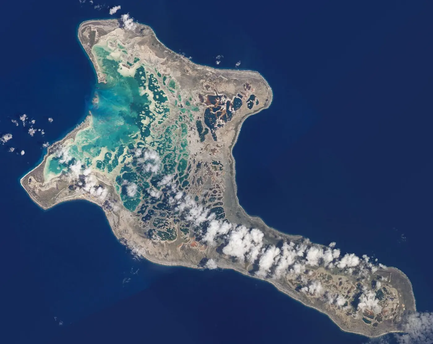
The 1884 conference fixed only the prime meridian, not the date line. That gap shows the date line is not a treaty line but the sum of individual countries' choices.
3. The First Deviation: The Bering Strait and the Diomede Islands’ 21-Hour Gap
Follow the date line south from the top of the world, and the first great bend comes at the Bering Strait, which separates Siberia from Alaska. Here the 180th meridian cuts straight through the Chukotka Peninsula, Russia’s easternmost territory. If the date line had followed 180° longitude exactly, people in the Russian Far East would have faced serious administrative confusion. Within one country, people on opposite sides of a single street would have lived on different dates and different days of the week.
To prevent this, the date line bends sharply eastward north of the Bering Strait. That keeps all Russian territory on the west (Asian) side of the line. The line then crosses the middle of the strait at an angle, creating one of the world’s most dramatic geographical oddities.
Two small rocky islands sit in the middle of the strait. One is Russia’s Big Diomede (Ratmanov Island); the other is America’s Little Diomede (Krusenstern Island). They lie only 3.8 km apart. But the date line and the U.S.–Russia border run between them. As a result, Big Diomede’s clocks are 21 hours ahead of Little Diomede’s in winter, or 20 hours when daylight saving time applies. Two islands in plain sight of each other become, in effect, ‘Tomorrow Island’ and ‘Yesterday Island,’ a day apart.
Next, the line bends deep to the southwest, detouring to about 170° west longitude. This keeps Alaska’s Aleutian Islands entirely on the American date, east of the line. Then it returns to the 180th meridian.
Two islands 3.8 km apart yet 21 hours apart tell us something. They show that what sets the date is not distance but which country a place belongs to.
4. The Second Deviation: The Republic of Kiribati's Great Shift and the World's First New Year (UTC+14)
The largest and most dramatic man-made bend in the date line’s history came in 1995. It was created by the Republic of Kiribati, an island nation in the equatorial Pacific. Kiribati stretches more than 3,000 kilometers from east to west. It is made up of three main archipelagoes: the Gilbert Islands, the Phoenix Islands, and the Line Islands. The Phoenix Islands are inscribed as a UNESCO World Heritage site. When the date line ran south along the 180th meridian, it mercilessly split Kiribati’s territory in two, right through the middle.
The capital, Tarawa, is in the Gilbert Islands. When it was Friday there, it was still Thursday in the Line Islands to the east. When the capital started work on Monday, the eastern islands were resting on Sunday. When the capital finished on Friday, the eastern islands were only beginning Friday. So only three weekdays a week—Tuesday, Wednesday and Thursday—let both sides do business at the same time.
Government correspondence, school operations and trade administration became completely paralyzed. In 1994, the Kiribati government took a drastic step: it moved its entire territory to the west of the date line, effective January 1, 1995. To do this, it created UTC+13 for the Phoenix Islands. For the Line Islands, it created the world's first UTC+14 time zone.
As a result, the date line now bulges more than 1,000 kilometers eastward in a huge horseshoe. It reaches Kiribati's eastern edge, around 150° west longitude, which is farther east than Honolulu, Hawaii. On January 1, 2000, Kiribati's Caroline Island was the first place on Earth to see the first sunrise of the 21st century. It was renamed 'Millennium Island' and became a world-famous tourist attraction.

Kiribati's real problem, it turns out, was mismatched weekdays rather than the time difference itself. That a single government decision moved the line can be read as a concrete example of a line with "no legal international status."
5. The Third Deviation: Fiji, Where the 180th Meridian Crosses the Middle of Its Territory, and the Choices of the South Pacific
Fiji lies in the Melanesian islands, around 16° to 20° south latitude. Geometrically, it was the most awkward country of all. The 180th meridian did not pass through sea there; it ran straight through the land of Taveuni and Rabi, two of Fiji’s main islands. In theory, one village on Taveuni faced a bizarre split: a house’s living room would be in today while its kitchen was in yesterday.
To keep its territory from being divided, the Fijian government passed domestic laws: the Interpretation Act and standard time regulations. These put the whole country on UTC+12, the time used west of the 180th meridian. Today a large monument marks where the 180th meridian crosses northern Taveuni Island. Travelers can stand astride the line, with one foot in the Eastern Hemisphere and one in the Western Hemisphere. Yet the official calendars and clocks of the whole island share one unified day of the week.
The Kingdom of Tonga made a similar choice. Geographically, it lies near 175° west longitude, so it would naturally belong to the Western Hemisphere (UTC-11 or -10). But Tonga wanted to keep its Christian tradition of a strict Sunday Sabbath. It also wanted its weekdays to match those of its main trading partners, New Zealand and Australia. So it had the date line detour eastward and chose UTC+13.
The zigzag line through the South Pacific islands is not a flag of territory planted on the ocean. It is a trace of practical survival: trading with neighboring countries and keeping in touch with family.
Setting Fiji beside Tonga shows that similar bends can have different reasons. Fiji can be read as putting national unity first, and Tonga as putting shared weekdays with its neighbours first.
6. The Geometry of the Date Line: The Principle of the Two Hours in Which Three 'Todays' Exist on Earth at the Same Time
At school, we learn that the world has 24 time zones, from UTC-12 to UTC+12, so the whole Earth spans exactly 24 hours. But Kiribati introduced UTC+14, and Samoa adopted UTC+13. Since then, the Earth’s actual range of time zones has stretched to a full 26 hours, from UTC-12 to UTC+14. This structure, two hours longer than 24, creates a truly astonishing calendar paradox.
Every day, for two hours—from 10:00 to 11:59 Coordinated Universal Time (UTC)—three different calendar dates exist on Earth at once. Take the moment when it is 10:30 a.m. on May 2 UTC. Kiribati's Line Islands (UTC+14), in the world's earliest time zone, have already passed midnight. They are living in tomorrow, at 00:30 on May 3. London (UTC+0), which keeps universal time, is still in today, at 10:30 a.m. on May 2. At that same instant, Korea is at 7:30 p.m. on May 2.
Meanwhile, Howland and Baker (UTC-12), uninhabited U.S. islands just east of the date line, are still in yesterday. Their clocks read 10:30 p.m. on May 1. For those two hours, three dates—May 1, May 2 and May 3—legally exist on Earth at the same time. The Earth's date does not change in one clean cut, as if sliced by a knife. Instead, it sweeps across the globe like a huge wave spanning 26 hours.
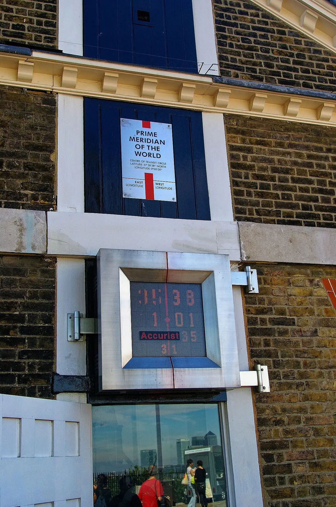
The 26-hour span, we can see, was created not by nature but by national decisions. The textbook's 24 time zones reflect the geometry of longitude, while actual clocks can be read as the outcome of political choices.
7. How Modern Navigation, Aviation and the Digital World Solve It: Erasing Local Dates and Navigating by UTC (Zulu)
If the date line bends in such complicated ways, how do flights and ships avoid mixing up the date? Hundreds of international passenger flights and container ships cross the Pacific every day, and they still operate safely. Consider a flight from Incheon to Los Angeles. It takes 11 hours, yet the local arrival time is stamped earlier than the departure time. This almost magical effect never fails to bewilder travelers.
Aviation and shipping solve the problem in a very clear way: they keep local dates and times out of their operating systems entirely. Two bodies set the rules here: the International Civil Aviation Organization (ICAO) and the International Maritime Organization (IMO). Under their rules, all air traffic control (ATC), flight plans, pilot communications and ships' logs worldwide use one reference. That reference is Coordinated Universal Time (UTC), the Greenwich-based standard, which air traffic control calls Zulu Time.
Picture an aircraft leaving Incheon Airport and crossing the date line. In talking to the control tower, it ignores whether the local date has changed. It reports only the absolute UTC time that the whole world shares.
Software works in a similar way. The back ends of smartphones and global booking systems rely on the Time Zone Database (tzdb). It is maintained by the Internet Assigned Numbers Authority (IANA). The database delivers real-time patches that automatically sync changes announced by national governments, including date line shifts and daylight saving time adjustments. Modern technology has not removed the zigzag's complexity. Instead, it has laid one absolute coordinate, UTC, beneath it, erasing the confusion for human society.
All the 1884 conference actually settled was the Greenwich prime meridian. It makes an interesting contrast that today's aviation and shipping also rely on a Greenwich-based reference, UTC.
8. What Eight Facets Reveal About the Nature of the Date Line: Humanity's Practical Compromise Drawn on Nature's Meridian
We have traveled from Magellan’s logbook to Kiribati’s UTC+14 and the Diomede Islands in the Bering Strait. We have also seen the geometry of the two hours when three dates coexist. Everything we have examined about the date line points to one clear conclusion.
First, the line shows that civil time is, at heart, a tool for human cooperation. Mathematical meridians are natural physical coordinates. But deciding which day it is, and how the working week runs, belongs entirely to sovereign human societies.
Second, the zigzags show that keeping territory together and serving communities rightly come before geometric tidiness. Our related study on statecraft and standard time (The Politics of Time Zones) explores this idea further. Clocks and calendars are evolving social contracts. The jagged path across the Pacific Ocean is a living record of how civilizations, over five centuries, balanced global navigation with the daily realities of life on Earth.