1. The Origin of the Name and Historiographical Clarification
Many people picture the Silk Road as a single caravan of camels marching across the dunes. In this picture, one line runs straight from Chang'an (modern Xi'an) to Rome. However, UNESCO and modern historians consistently use the plural name Silk Roads (UNESCO Silk Roads Programme). For two millennia, these trade and cultural channels were never a fixed, unchanging highway. They were a shifting, connected maze of mountain trails, oasis tracks, river routes, steppe paths, and ocean sea lanes. The routes changed with political stability, climate pressures, and market demand.
Also, ancient merchants never called their routes the "Silk Road." By convention, historians credit the modern term to Ferdinand von Richthofen, a German geographer and geologist. On 2 June 1877, he gave a lecture to the Berlin Geographical Society. Its title was “Über die zentralasiatischen Seidenstrassen bis zum 2. Jh. n. Chr.” (On the Central Asian Silk Roads up to the 2nd Century AD) (Smithsonian National Museum of Asian Art; UC Berkeley Library Guides).
However, careful bibliographical research complicates this story. In 2019, Matthias Mertens published a study titled “Did Richthofen Really Coin 'the Silk Road'?”. It shows that the term was not coined in a vacuum (The Silk Road Journal). Terms meaning “silk roads” had already appeared in earlier German scholarly works. These included works by Carl Ritter (1838), Ernst Kaeuffer (1858), Hermann Guthe (1868), and Richard Mack (1874).
So Richthofen did not invent the phrase from scratch. His real contribution was a rigorous historical-geographical definition of the ancient trade axis linking Han China and the Roman world. He also made the term popular in international academic discussion. Importantly, Richthofen deliberately used the plural form (Seidenstrassen). This shows he knew the network had many sides.
2. The Myth of Transcontinental Caravans and the Reality of Relay Trade
A romantic idea holds that single merchants carried cargo all the way from the gates of Chang'an to the shores of the Mediterranean. Economic history gives this idea little support. Imperial ambassadors, religious pilgrims, and exceptional travelers did complete journeys across the continent. Regular commerce, however, worked mainly through **relay trade** (UNESCO).
Merchant groups usually traveled back and forth along just one segment of the route. They knew that segment's language, business customs, terrain and climate, and system of tolls. When goods reached an oasis city or hub market, they were sold to local merchants there. The price covered that segment's transport costs, a risk premium for crossing the desert, tolls, and the merchant's profit. The merchant in charge of the next segment then bought the goods. He carried them to the neighboring market, and the process repeated.
As a result, the weaver of a silk garment never once met its final wearer, a Roman aristocrat in the Mediterranean. The garment reached that wearer through transactions involving dozens of intermediaries and markets.
This relay structure also shaped what kinds of goods were traded. Pack animals such as camels and horses could carry only limited weight overland. So the goods that survived the long journey to the final stage were mostly luxury items. These were small and light, yet extremely high in price per unit.
At the same time, goods passed through several cultural spheres along the way. In each, they might be dyed or reworked to suit local tastes and consumption habits. Weaving techniques and motifs were also adapted locally. The result was a kind of cultural hybridization.
3. Oasis Towns as Network Switches: The Multilingual Archive of the Dunhuang Mogao Caves (No. 440)
Central Asia and western China have rugged terrain. What kept the Silk Roads from breaking apart there was a chain of oasis cities. They were strung out along the Taklamakan Desert and the Tianshan Mountains. These oasis cities were more than supply depots. They worked as 'network switches,' controlling and linking trade routes that branched off in many directions.
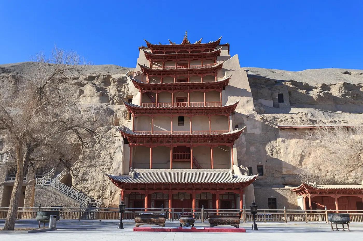
The leading example of such a junction is Dunhuang, in northwestern Gansu Province. Here stand the Mogao Caves (No. 440), inscribed on the UNESCO World Heritage List in 1987. The caves sit at a key point where the northern and southern routes around the Taklamakan Desert split apart. The UNESCO World Heritage Centre (WHC) citation describes the site as “situated at a strategic point along the Silk Route, at the crossroads of trade as well as religious, cultural and intellectual influences… near where the two branches of the Silk Road forked.”
In the early twentieth century, the Library Cave (Cave 17) was discovered. It held tens of thousands of manuscripts. They record Dunhuang’s role as an administrative, linguistic, and trading crossroads. According to UNESCO’s official heritage documentation, the manuscripts from Mogao represent six main historical languages: Chinese, Tibetan, Sogdian, Khotanese, Uyghur, and Hebrew.
The texts include Buddhist scriptures, sale contracts, loan agreements, customs registers, and personal letters. Together, they show the services that oasis hubs offered traders. These included legal arbitration, currency exchange, cargo repacking, translation, and lodging. All were essential for trade between cultures.
4. Commodities Beyond Silk: The Diffusion of Technology and Faith
Silk gave the network its evocative nineteenth-century name. Yet the range of goods exchanged was very broad. Official records of the UNESCO Silk Roads Programme list the main commodities documented along the routes. They included textiles, spices, grain, fruits, hides and leather, tools, timber, metals, religious objects, artworks, and precious stones (UNESCO Silk Roads Programme).
The spread of production techniques and knowledge had a deeper impact on world history than the movement of finished goods. Paper making is a key example. Developed in China, it spread through Central and West Asia to Europe. There it brought a decisive change to printing and book production.
Infrastructure mattered too. To help caravans cross deserts and mountains safely, **caravanserais** (caravan inns) were set up along the routes. They stood roughly 30 to 40 kilometers apart. That is the distance a camel or mule can march in a single day. These inns formed the backbone of the routes' logistics.
Spiritual culture and faith also spread across the continent along the trade routes. Major religions of humanity traveled with the caravans of merchants, monks, and envoys. They included Buddhism, Christianity (in several traditions, including the Church of the East), Islam, Hinduism, Zoroastrianism, and Manichaeism. The trade networks offered safety and a web of lodgings. This was the physical foundation that made missionary work and the spread of religious ideas possible.
5. Sogdian Merchants' Financial and Credit Networks and the Dunhuang Ancient Letters
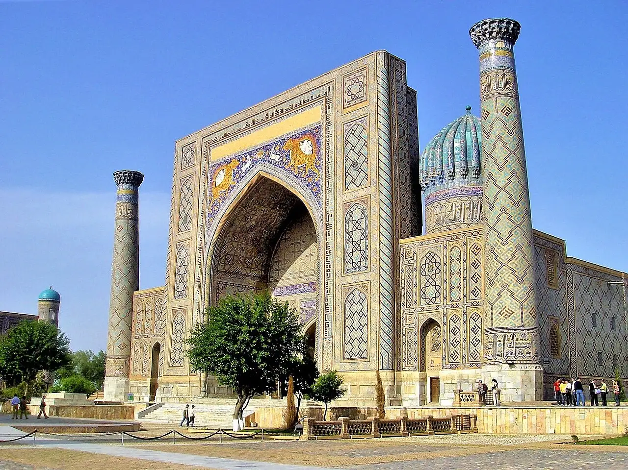
Throughout the first millennium CE, the leading commercial go-betweens on the overland Central Asian routes were the **Sogdians**. They were an Iranian people whose homeland centered on the Zarafshan and Kashkadarya river valleys, in modern Uzbekistan and Tajikistan. They set up merchant colonies from the Oxus to the inner capitals of China. Their networks ran transcontinental trade under elected or appointed community chiefs (Smithsonian National Museum of Asian Art).
Proof of how sophisticated Sogdian commerce was came to light in 1907. That year, Aurel Stein, a British archaeologist, discovered the **Sogdian Ancient Letters**. He found them in an abandoned watchtower about 90 kilometers west of Dunhuang, near the Jade Gate (Smithsonian Ancient Letters).
Nicholas Sims-Williams produced the definitive English translation of the letters. In his translation, Letter 2 clearly mentions the catastrophic sack of Luoyang, the Chinese imperial capital, by Xiongnu forces in 311 CE. This dates the letters to roughly 312–313 CE (University of Washington Silk Road Texts).
The letters record in detail how merchants managed deposits entrusted to one another. They also record the settlement of loans and interest, and the accounts of consignment sales. This proves that a financial mechanism was already working in the early fourth century. Through commercial credit networks and exchanged letters, merchants could settle accounts and deliver goods over long distances. They did not need to load physical gold and silver coins onto camels and cross dangerous deserts. As the Smithsonian notes, Sogdian served as the de facto lingua franca, or shared common language, of overland trade on the ancient Silk Roads.
6. The Maritime Silk Roads: Quanzhou as an Indian Ocean Emporium (No. 1561)
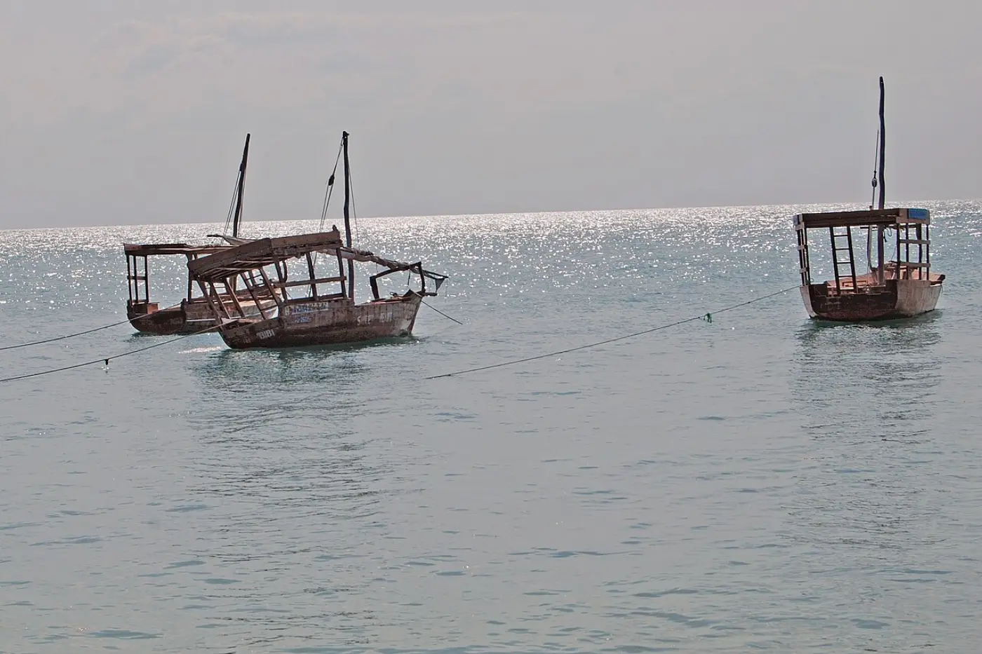
Limiting the Silk Roads to camel tracks on land overlooks half of Eurasia's economic connections. From the eighth century onward, sea shipping expanded dramatically. It linked the Persian Gulf, the Red Sea, the Indian Ocean, and South China. This created the **Maritime Silk Roads**, which could move bulk freight far beyond what overland transport could carry (UNESCO).
The high point of medieval sea connections is honored by a UNESCO World Heritage site: Quanzhou: Emporium of the World in Song-Yuan China (No. 1561), inscribed in 2021. As UNESCO documents, Quanzhou flourished from the tenth to the fourteenth century. It was the leading maritime hub of East and Southeast Asia. The site includes twenty-two connected archaeological components. Among them are docks, navigation pagodas, production kilns, and sanctuaries of many faiths.
In central Quanzhou stands the Qingjing Mosque, an eleventh-century Islamic mosque. Together with the city's varied religious sites, it reveals a multicultural port city. Foreign merchants from Arabia, Persia, and Southeast Asia formed self-governing communities there and traded freely. Ships sailed out and returned in rhythm with the monsoon cycle. They carried bulk cargoes of ceramics, metals, tea, and aromatics.
Sea and land routes were not separate systems. Cargo arriving in port moved on along inland canals and roads to rejoin the oasis trade routes. Together, they formed a complementary, integrated Eurasian multimodal transport network.
7. The Two Inscribed UNESCO Silk Roads Corridors
The Silk Roads cover a vast geographical area. So UNESCO has not inscribed them on the World Heritage List as a single property. Instead, it uses units of transnational “serial property corridors.” Here is a key historical and institutional fact: **only two Silk Roads corridors have actually been formally inscribed** by the UNESCO World Heritage Committee:
- Silk Roads: the Routes Network of Chang'an-Tianshan Corridor: Inscribed in 2014 under Reference No. 1442. Jointly submitted by China, Kazakhstan, and Kyrgyzstan, this serial property extends approximately 5,000 kilometers from the ancient Chinese imperial capitals of Chang'an and Luoyang across the Tianshan Mountains into the Zhetysu region of Central Asia. It encompasses thirty-three component sites, including capital complexes, palaces, Buddhist cave temples, oasis fortresses, beacon towers, and mountain passes. (Note: The figures of 7,500 km and 35,000 km in UNESCO background literature describe the broader research network, whereas the inscribed property itself spans roughly 5,000 km.)
- Silk Roads: Zarafshan-Karakum Corridor: Inscribed in 2023 under Reference No. 1675. Jointly nominated by Tajikistan, Turkmenistan, and Uzbekistan, this 866-kilometer corridor connects thirty-four component sites stretching from rugged Pamir mountain valleys along the Zarafshan River and across the hyper-arid Karakum Desert to the Merv oasis. (Note: The historic urban centers of Samarkand and Bukhara are inscribed as separate World Heritage properties and do not form part of serial property No. 1675.)
By contrast, the Fergana-Syrdarya Corridor (Silk Roads: Fergana-Syrdarya Corridor) appears only on UNESCO's **Tentative List**. Kyrgyzstan and others submitted it in January 2025. It has not been confirmed as a formally inscribed World Heritage property. So the Silk Roads corridors recognized by scholars and institutions should be understood as the two axes of No. 1442 and No. 1675.
8. Lessons from the British Museum Special Exhibition (500–1000 CE) and Today's Perspective
From 26 September 2024 to 23 February 2025, the British Museum presented a landmark exhibition, *Silk Roads* (British Museum). It set out a modern historical framework for understanding these ancient connections. Its core curatorial idea challenged Eurocentric and Sinocentric (Europe-centered and China-centered) frameworks:
“Rather than a single trade route from East to West, the Silk Roads were made up of overlapping networks of people, objects and ideas, from East Asia to Britain, and from Scandinavia to Madagascar.” (Exhibition description, covering 500–1000 CE)
Between 500 and 1000 CE, this exchange network bound Eurasia and Africa together. It was not a channel through which one particular civilization one-sidedly dominated or civilized another. Historical evidence shows this. Viking silver coins circulated together with the silver dirhams of the Islamic empires of Central Asia. Spices from the Indian Ocean reached monasteries on the island of Britain. Such evidence proves that the ancient and medieval worlds were far more plural and densely connected than we imagine.
Modern travelers and researchers visit Dunhuang, Samarkand, or Quanzhou. For them, the essential task is to discard romantic Orientalist clichés. These sites are not stage sets celebrating an abstract "meeting of East and West." They are living cultural landscapes, cared for by local communities. Those communities endured environmental instability, war, and political change.
To explore how heritage is protected, consult the founding principles of UNESCO World Heritage conservation and global geographic literacy. Together, they offer a critical foundation for understanding how overlapping routes shaped our connected world.